Tag Archive for Branson

COMPETING OZARK TOURISM ICONS: Old Matt’s Cabin vs. Bagnell Dam

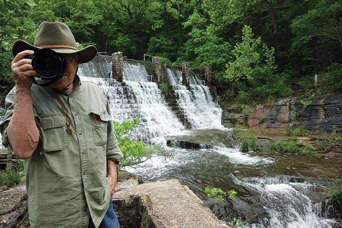
The two biggest tourist centers of the Ozarks are Branson and Lake of the Ozarks. While graphics used to promote travel do not necessarily accurately or honestly represent those places, they can betray the character and history of places. Such is the case with the imagery used to advertise and decorate souvenirs of these two attractions.

Souvenirs from the Shepherd of the Hills Country (Branson). Its dominant motif is Old Matt’s Cabin from Harold Bell Wright’s “The Shepherd of the Hills.” Tourism and recreation were not add-ons to a dam and reservoir project here. They long preceded the building of artificial reservoirs and featured fishing and outdoor recreation with the bucolic locals playing a role.

Branson, near the Missouri-Arkansas line in southwest Missouri, began attracting travelers in the early 190s. Harold Bell Wright’s bucolic novel, Shepherd of the Hills, drew attention to the upper White River hills and their rustic inhabitants. Wright portrayed the inhabitants as colorful primitives and locals claimed to be the inspiration for various characters. The Ross house, known as Old Matt’s Cabin, became a symbol of for the area. It decorated brochures and gifts communicating that a vacation in the Shepherd of the Hills country was trip to the trouble-free past.

Lake of the Ozarks souvenirs feature Bagnell Dam, which created the reservoir for hydro-electric power, not recreation or flood control.

Lake of the Ozarks, on the northern flank of the Ozarks was created in 1931 by the closing of Bagnell Dam. This blockage of the Osage River was built by Union Electric (now AmerenUE) to supply electricity. Lacking any comparable settler mythos, pictures of the dam represented the new lake. This wonder of technology was plastered on tourist promotions and souvenirs. From the beginning, its recreational attractions have been hedonistic pleasure, boating, and fishing in the 54,000-acre reservoir. Perhaps the difficulty of picturing the artificial lake led to the inappropriate use of an industrial structure.
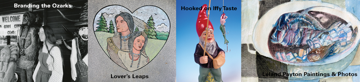


Most Lens & Pen titles are on sale on our website for half price, postage paid.  See the Ozarks: The Touristic Image, where you can find many more examples of this contrasting branding, is now $12.50, postage paid.


A SUNRISE STROLL BY THE “Y” BRIDGE ALONG THE JAMES RIVER

Click to enlarge.

Click to enlarge.

Fog obscures the James beneath the Y Bridge at Galena Missouri. There is a riffle under the bridge, but I do not hear it. Looking off the west end of the bridge I can make out a small house and several trailered flat-bottomed boats in the yard. Exiting the bridge I take a left. A few hundred yards down that road looms a huge rusty sign. Incredibly, most of the fragile white neon tubing still outlines the letters. It reads BILL ROGERS MOTEL CAFÉ FLOAT …

There’s no sign the motel is still renting rooms or serving fried eggs and bacon to floaters. A row of rooms is still behind the sign but they have been painted yellow. On a 1950s postcard they are coral. On the back of the chrome postcard is “BILL ROGERS MOTEL RESTAURANT FISHING SERVICE On James River write bl409box 233, Galena, Missouri phone Elmwood 7-2641 air conditioned 15-unit Motel, electric heat, Large, air conditioned Restaurant, Fishing, Tackle and Supply Store. All these have been added to our long-established Float Fishing Service in the Float Capital of the World.”

This whole 1950s Bill Rogers operation looks like bl408an improvident business decision. While Galena could once claim the title of “float capital of the world,” Dewey Short’s big lake was about to swallow up almost all the floatable James River. The 6,323 foot long, 252-foot high dam near Branson would back the White River up the James to within five miles of his “long-established Float Fishing Service” in 1958.

bl411When the White River Division of the Iron Mountain and Southern Railway cut through Stone County before World War I, it opened the possibility of sportsmen detraining at Galena and engaging one of the services that provided a flat bottomed wooden john boat along with a colorful, yarn-spinning, gravel bar cook for an epic five-day float the 125 miles down the James, then the White, down to Branson. The train would haul the boats back and take the fishermen to Galena or wherever they called home.

00036

Real photo postcard of James River circa 1915. Taken by George Hall. Camp Yocum was several miles upstream from Galena. The family settled in the region before 1800 and reputedly issued their own “Yocum Dollars” made by melting silver US and Spanish coins. These were used for trade with the Indians, principally the Delaware. No known examples have survived.

The improvement of roads and modern bridges like the Y made this celebrated ritual even easier. Sports writers immortalized the James and this float for decades. Movie stars, Catholic bishops, and affluent urbanites flooded to Galena to indulge in the ritual.

Congressman Dewey Short’s 4,100-acre chunk of flat water hasn’t completely stopped floating the James, but it cut it off at the knees. There’s almost nothing of the free flowing James below Galena, but there is still a decent one-day experience canoeing from Hootentown down to the Y Bridge takeout.  In high water one can put in further up the cliff-lined, forested free flowing James.

The very unusual Y Bridge is readily detectable in this Google Earth satellite image. To the north is the new very sound, but less aesthetic bridge that crosses the James River on Missouri Route 76. After photographing the Y Bridge I wandered south from the west, Galena side of the old bridge.

The very unusual Y Bridge is readily detectable in this Google Earth satellite image. To the north is the new very sound, but less aesthetic bridge that crosses the James River on Missouri Route 76. After photographing the Y Bridge I wandered south from the west, Galena side of the old bridge.

Click on any image to start slide show of Galena’s river front. Truncated as it is by Table Rock Reservoir, the James is still an attractive, wild, and fishable but shorter float.


RUINS OF DOGPATCH USA – PART 2

Billboard two miles north of the ruins of Dogpatch USA on Arkansas Highway 7, south of Harrison.

Billboard two miles north of the ruins of Dogpatch USA on Arkansas Highway 7, south of Harrison.

Across the road from the peeling Dogpatch USA billboard is a contemporary smaller sign illustrating the Edenic recreational opportunities of the Buffalo River country. This wild and scenic stream in 1972 became the first National River and is administered by the U. S. Park Service.  (click to enlarge).

Across the road from the peeling Dogpatch USA billboard is a contemporary smaller sign illustrating the Edenic recreational opportunities of the Buffalo River country. This wild and scenic stream in 1972 became the first National River and is administered by the U. S. Park Service. (click to enlarge).

A keen observer of popular culture, Roger Brown, published an article called Dogpatch USA: The Road to Hokum, published in Southern Changes, The Journal of Southern Regional Council (1993). Brown actually set foot in the park shortly before its demise:

Dogpatch USA is a classic American roadside attraction. It’s a basket of cornpone and hillbilly hokum in a beautiful Ozark mountain setting. Nearby is a waterfall, limestone caverns, and a spring that flows clear and steadily into a creek that has powered a gristmill for more than 150 years. The decor is bumpkin kitsch.

Though Brown enjoyed the “hokum”, he found the place had “surreal” aspects that the patrons likely missed:

What most of the visitors didn’t fully realize, however, was that they were participating in a moment rich with a sort of postmodern poetics which has since become commonplace: The Arkansas syndicate that built Dogpatch USA was peddling colonial stereotypes as family entertainment, and at the core of the park’s attraction was a complex melody conjured by the dueling banjos of simulation and authenticity.

He interviewed Melvin Bell who bought the park from investors who acquired it at a bankruptcy auction held on the courthouse steps in Jasper after Odum went bust. The auctioneer’s wife once played “Daisy Mae” at Dogpatch. Bell thought the growth that was happening 45 minutes away at Branson would help Dogpatch. Brown also gave some credence to that incorrect idea.

Since 1906, Branson had aggressively pursued tourism with the assistance of Harold Bell Wright and the Missouri Pacific Railroad. A four lane highway now connected the Shepherd of the Hills country with an interstate highway. Silver Dollar City, Dogpatch USA’s competitor, didn’t lock in its image to a clever, but sarcastic comic strip. Folksy Romanticism was in. Irony apparently didn’t appeal to the generation who saw nothing wrong with protesters like leftist folk singer Joan Baez, who Capp had satirized as “Jonnie Phoanie”. Though Silver Dollar City tolerated some fringe hillbilly-ness the park played up a hillfolk portrayal a la Harold Bell Wright and emphasized native crafts. Al Capp might have done a takeoff on the hillbilly Las Vegas, as the neon lit booming Branson was misleadingly called. Early on, he had ripped Shepherd of the Hills in his comic strip.

h1211

In the spring of 2014, we wandered through the abandoned Lil’ Abner themed venture in Northern Arkansas. That summer, newspaper articles began popping up announcing that the long closed attraction had a new owner. Charles “Bud” Pelsor and investor James Robertson and wife of Newbury Park, California had purchased 400 acres of the troubled property. Other sections had been already disposed of.

Pelsor, inventor of the Spill Proof Dog Bowl, had big plans. He announced he would restore the old grist mill and with grain milled on the grounds bake artisan bread. He wanted to fix the train tracks that once circled the park and buy back the little locomotive. Trout would be stocked and served at a restaurant. Fresh water mussels would produce pearls. Dilapidated buildings would be reborn. No more locals dressed as characters from a hillbilly comic strip would communicate with visitors in an anachronistic vernacular regional dialect. In other words, Pelsor is not going to go hillbilly with his theme park. The Harrison Daily Times ran an article titled “This Place is Magical” on September 3, 2014 that said: “The park will be geared to eco-tourism. They will plant gardens, orchards, and vineyards.”

Click any image to start the slideshow of Crystal Payton’s photographs of abandoned Dogpatch USA, May, 2014.