A SUNRISE STROLL BY THE “Y” BRIDGE ALONG THE JAMES RIVER

Click to enlarge.

Click to enlarge.

Fog obscures the James beneath the Y Bridge at Galena Missouri. There is a riffle under the bridge, but I do not hear it. Looking off the west end of the bridge I can make out a small house and several trailered flat-bottomed boats in the yard. Exiting the bridge I take a left. A few hundred yards down that road looms a huge rusty sign. Incredibly, most of the fragile white neon tubing still outlines the letters. It reads BILL ROGERS MOTEL CAFÉ FLOAT …

There’s no sign the motel is still renting rooms or serving fried eggs and bacon to floaters. A row of rooms is still behind the sign but they have been painted yellow. On a 1950s postcard they are coral. On the back of the chrome postcard is “BILL ROGERS MOTEL RESTAURANT FISHING SERVICE On James River write bl409box 233, Galena, Missouri phone Elmwood 7-2641 air conditioned 15-unit Motel, electric heat, Large, air conditioned Restaurant, Fishing, Tackle and Supply Store. All these have been added to our long-established Float Fishing Service in the Float Capital of the World.”

This whole 1950s Bill Rogers operation looks like bl408an improvident business decision. While Galena could once claim the title of “float capital of the world,” Dewey Short’s big lake was about to swallow up almost all the floatable James River. The 6,323 foot long, 252-foot high dam near Branson would back the White River up the James to within five miles of his “long-established Float Fishing Service” in 1958.

bl411When the White River Division of the Iron Mountain and Southern Railway cut through Stone County before World War I, it opened the possibility of sportsmen detraining at Galena and engaging one of the services that provided a flat bottomed wooden john boat along with a colorful, yarn-spinning, gravel bar cook for an epic five-day float the 125 miles down the James, then the White, down to Branson. The train would haul the boats back and take the fishermen to Galena or wherever they called home.

00036

Real photo postcard of James River circa 1915. Taken by George Hall. Camp Yocum was several miles upstream from Galena. The family settled in the region before 1800 and reputedly issued their own “Yocum Dollars” made by melting silver US and Spanish coins. These were used for trade with the Indians, principally the Delaware. No known examples have survived.

The improvement of roads and modern bridges like the Y made this celebrated ritual even easier. Sports writers immortalized the James and this float for decades. Movie stars, Catholic bishops, and affluent urbanites flooded to Galena to indulge in the ritual.

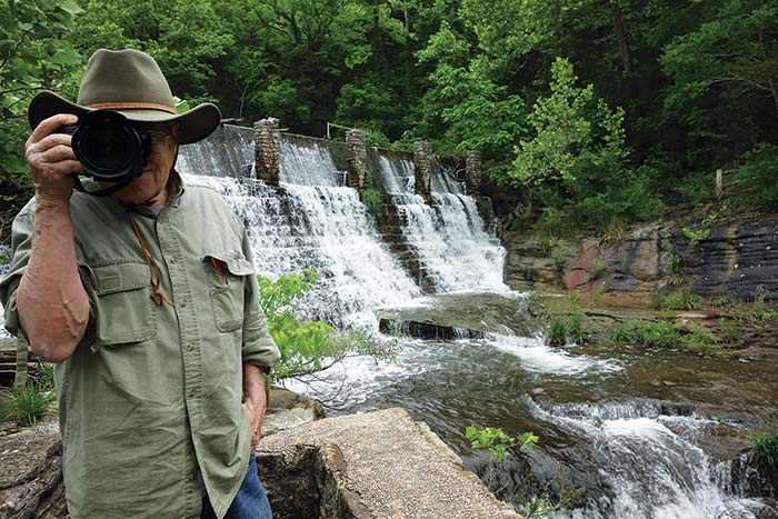
Congressman Dewey Short’s 4,100-acre chunk of flat water hasn’t completely stopped floating the James, but it cut it off at the knees. There’s almost nothing of the free flowing James below Galena, but there is still a decent one-day experience canoeing from Hootentown down to the Y Bridge takeout.  In high water one can put in further up the cliff-lined, forested free flowing James.

The very unusual Y Bridge is readily detectable in this Google Earth satellite image. To the north is the new very sound, but less aesthetic bridge that crosses the James River on Missouri Route 76. After photographing the Y Bridge I wandered south from the west, Galena side of the old bridge.

The very unusual Y Bridge is readily detectable in this Google Earth satellite image. To the north is the new very sound, but less aesthetic bridge that crosses the James River on Missouri Route 76. After photographing the Y Bridge I wandered south from the west, Galena side of the old bridge.

Click on any image to start slide show of Galena’s river front. Truncated as it is by Table Rock Reservoir, the James is still an attractive, wild, and fishable but shorter float.


ON THE “Y” BRIDGE IN THE FOG: A DIMLY SEEN ART MODERNE MASTERPIECE

bl400

I’m in a still photo, nothing moves. Sounds are as muted as the monochromatic fall colors. Is the sun up yet? The fog makes it hard to tell. Standing on the closed-to-vehicular-traffic bridge across the James River at Galena, Missouri I remember a vintage photograph we bought years ago.

Galena’s 1927 Art Deco bridge was the result of booster civic organizations’ agitation for improved roads to encourage tourism. It helped augment the railroad delivering vacationers to this region of the Ozarks already known as the Shepherd of the Hills. Harold Bell Wright’s romantic novel was set in Taney and Stone counties.

Galena’s 1927 Art Deco bridge was the result of booster civic organizations’ agitation for improved roads to encourage tourism. It helped augment the railroad delivering vacationers to this region of the Ozarks already known as the Shepherd of the Hills. Harold Bell Wright’s romantic novel was set in Taney and Stone counties.

A crowd of some three thousand assembled here on the 23rd of November 1927 for the grand opening of the new Y Bridge. Probably the unrecorded remarks made by the highway engineers and a Missouri Pacific Railroad superintendent stressed the technical accomplishment of the structure. When built it was the longest concrete arch bridge in the state. The concluding speaker was Dewey Jackson Short, who would run the next year for the U.S. Congress.

This was a golden opportunity to display his oratorical skills to a large group of voters. Unfortunately we have not been able to find the speech he gave to the throng of Ozarkers. Short’s command of English became nationally recognized during his subsequent twenty-two years in Congress. Not only did this self-styled hillbilly have degrees from several small American colleges, he studied at Harvard, Heidelberg University, and Oxford University, and he was a Methodist preacher.

If anyone knows if his remarks were preserved we’d love to hear from you.

The Springfield News Leader did report that Short understood the wonderful bridge would deliver tourists with money in their pockets to the formerly somewhat inaccessible region: “Short concluded his speech with a special plea for further development of the tourist industry in Stone County. He declared that the continuing possibilities of tourist dollars flowing from improved transportation made the local tourist industry stand beside the cow, the fruit, and the hen in local importance.”

Doubtlessly the arch conservative Republican who would later become renowned for his vitriolic opposition to Roosevelt and the New Deal’s expansion of the federal government didn’t dwell on the fact the financing of the bridge was a joint state and federal arrangement. As an apostle of old fashioned self-reliance, Short was in theory opposed to federal handouts in any form. People, he lamented, “seemed to be suffering with the gim-mes. It is gim-me this, and gim-me that.” Throughout his career, however, Dewey seemed OK with barrels of dollars rolling in from Washington to his southwest Missouri district. Later many millions of federal funds went into a much larger chunk of government-poured concrete called Table Rock Dam. Recognizing the Congressman’s seminal role in authorizing and funding this huge water resource project they named their architect designed visitor center after the Honorable Dewey Short.

    A 1920s real photo postcard taken from a hill across the James from Galena. Not only is the bridge notable for its fork on the east side, it’s a splendid example of Art Moderne design.

A 1920s real photo postcard taken from a hill across the James from Galena. Not only is the bridge notable for its fork on the east side, it’s a splendid example of Art Moderne design.

Probably no speaker at the dedication commented on the Art Deco design of the Y Bridge. Art Moderne, as this neo-classical variety of Deco is called, became the preferred form for all manner of buildings throughout the country that were subsidized by the Roosevelt administration. The Y Bridge that helped to open up the Ozarks to tourists is a rare 1920s example of what became called Depression or WPA Modern. Thousands of post offices, schools, courthouses and other bridges were constructed in this style. Few are in such good shape or have been preserved unchanged like Galena’s Y Bridge.

bl396

A construction company in nearby Republic originally got the contract to build the bridge. They planned to use creek gravel in the concrete, which didn’t meet specifications. The Koss Construction Co. of Des Moines, Iowa said they would employ local labor as much as possible, but would use the required crushed limestone. Possibly they did in the load-bearing part, but the rails look suspiciously like they used the native orange-brown chert that can be seen on the gravel bar below.

Click here to read the National Register of Historic Places registration form for the Galena Y-Bridge. It’s a model of well-researched local history and goes into great detail about the role of the bridge in early tourism. Needless to say, the Y Bridge was enthusiastically included in the National Register of Historic Places in 1991.

Click on any image to start slide show.


RUINS OF DOGPATCH USA – PART 2

Billboard two miles north of the ruins of Dogpatch USA on Arkansas Highway 7, south of Harrison.

Billboard two miles north of the ruins of Dogpatch USA on Arkansas Highway 7, south of Harrison.

Across the road from the peeling Dogpatch USA billboard is a contemporary smaller sign illustrating the Edenic recreational opportunities of the Buffalo River country. This wild and scenic stream in 1972 became the first National River and is administered by the U. S. Park Service.  (click to enlarge).

Across the road from the peeling Dogpatch USA billboard is a contemporary smaller sign illustrating the Edenic recreational opportunities of the Buffalo River country. This wild and scenic stream in 1972 became the first National River and is administered by the U. S. Park Service. (click to enlarge).

A keen observer of popular culture, Roger Brown, published an article called Dogpatch USA: The Road to Hokum, published in Southern Changes, The Journal of Southern Regional Council (1993). Brown actually set foot in the park shortly before its demise:

Dogpatch USA is a classic American roadside attraction. It’s a basket of cornpone and hillbilly hokum in a beautiful Ozark mountain setting. Nearby is a waterfall, limestone caverns, and a spring that flows clear and steadily into a creek that has powered a gristmill for more than 150 years. The decor is bumpkin kitsch.

Though Brown enjoyed the “hokum”, he found the place had “surreal” aspects that the patrons likely missed:

What most of the visitors didn’t fully realize, however, was that they were participating in a moment rich with a sort of postmodern poetics which has since become commonplace: The Arkansas syndicate that built Dogpatch USA was peddling colonial stereotypes as family entertainment, and at the core of the park’s attraction was a complex melody conjured by the dueling banjos of simulation and authenticity.

He interviewed Melvin Bell who bought the park from investors who acquired it at a bankruptcy auction held on the courthouse steps in Jasper after Odum went bust. The auctioneer’s wife once played “Daisy Mae” at Dogpatch. Bell thought the growth that was happening 45 minutes away at Branson would help Dogpatch. Brown also gave some credence to that incorrect idea.

Since 1906, Branson had aggressively pursued tourism with the assistance of Harold Bell Wright and the Missouri Pacific Railroad. A four lane highway now connected the Shepherd of the Hills country with an interstate highway. Silver Dollar City, Dogpatch USA’s competitor, didn’t lock in its image to a clever, but sarcastic comic strip. Folksy Romanticism was in. Irony apparently didn’t appeal to the generation who saw nothing wrong with protesters like leftist folk singer Joan Baez, who Capp had satirized as “Jonnie Phoanie”. Though Silver Dollar City tolerated some fringe hillbilly-ness the park played up a hillfolk portrayal a la Harold Bell Wright and emphasized native crafts. Al Capp might have done a takeoff on the hillbilly Las Vegas, as the neon lit booming Branson was misleadingly called. Early on, he had ripped Shepherd of the Hills in his comic strip.

h1211

In the spring of 2014, we wandered through the abandoned Lil’ Abner themed venture in Northern Arkansas. That summer, newspaper articles began popping up announcing that the long closed attraction had a new owner. Charles “Bud” Pelsor and investor James Robertson and wife of Newbury Park, California had purchased 400 acres of the troubled property. Other sections had been already disposed of.

Pelsor, inventor of the Spill Proof Dog Bowl, had big plans. He announced he would restore the old grist mill and with grain milled on the grounds bake artisan bread. He wanted to fix the train tracks that once circled the park and buy back the little locomotive. Trout would be stocked and served at a restaurant. Fresh water mussels would produce pearls. Dilapidated buildings would be reborn. No more locals dressed as characters from a hillbilly comic strip would communicate with visitors in an anachronistic vernacular regional dialect. In other words, Pelsor is not going to go hillbilly with his theme park. The Harrison Daily Times ran an article titled “This Place is Magical” on September 3, 2014 that said: “The park will be geared to eco-tourism. They will plant gardens, orchards, and vineyards.”

Click any image to start the slideshow of Crystal Payton’s photographs of abandoned Dogpatch USA, May, 2014.


DOGPATCH USA THEME PARK – PART 1

When life and art collide the result is not always explosive. When Al Capp’s cartoon hillbillies were played by real Arkansas youngsters in a Dogpatch built of abandoned log cabins and sawmill shacks in an Ozark hollow, the result was more of an implosion. The failure of Dogpatch U.S.A. had the hollow poetry of “not with a bang but a whimper.” The deflation of interest in hillbillies in mass media in the late 1970s and ‘80s, along with the disappearance of Li’l Abner from the funny papers, were not its only challenges. Developers’ fantasies collided with geographic reality. An amusement park is a very real, material thing that has environmental specificities. A comic strip is a paper-thin illusion. Dogpatch USA was located on a winding two-lane blacktop, miles from anywhere and years too late.

h604Given the history of Arkansans trying to disassociate themselves from the Arkansas Traveler legend and other rude, backwoods mythos, it’s surprising that it was a group of local businessmen who dreamed up the idea. While Li’l Abner often had satiric sequences with little or no mountaineer clichés, its central characters were indisputably hillbillies who lived in a southern mountain setting. Capp had been pitched on a theme park based on Li’l Abner before, but he bit when Harrison, Arkansas real estate agent O. J. Snow and some friends approached him with an ambitious scheme. They proposed developing Mill Creek Canyon, a scenic valley just off the Buffalo River with a fifty-five foot waterfall, a trout lake, and several caves, into a complex of rides, restaurants, lodging and the entire obligatory theme park infrastructure that would attract tourists.

There were some sensitive souls in the Publicity and Parks Commission in Little Rock with reservations about the hillbilly image thing. By and large, though, the business community and state government got behind creating a job-creating, make-believe hillbilly-land smack dab in a region with an unflattering primitive reputation. All the good timber had been cut out years ago and subsistence farming lost its charm. Ozarkers were desperate for employment. If dressing up in ragged old clothes and talking ungrammatically through your nose entertained outsiders, then so be it. The hillbilly personae had been created primarily for urban consumption. Capp, DeBeck and Webb were hardly southern country boys. Still Arkansas natives, Lum & Abner, and Bob Burns had cashed in playing rusticated naïves. People in rural and small town settings chuckled at Snuffy and Li’l Abner too, although they generally preferred folksier versions of the mountaineer. By this time in history, city and country sensibilities were converging.

h1135Dogpatch USA actually got off to a promising start.

Li’l Abner’s creator gave a short speech to a crowd of eight thousand at the park’s opening on May 17, 1968. Capp and his wife also had been on site when ground was broken the preceding year. Then he said, “Of all the by-products of the strip, this is the one I’m most proud of.” Their adopted son, Colin Capp (Kim), came to Dogpatch in 1969 to help with sales and public relations. In an atypically harmonious blend of art and life, Kim fell in love with Moonbeam McSwine, or rather Vickie Cox, the local gal who played the sexy, but unhygienic temptress.

A million-three was spent on the park, and a big expansion was on the drawing boards. Four hundred thousand paying customers came; a million-two-hundred-thousand were projected for the next year. Alas, that first year was the high water mark. In the following twenty-five years attendance would never break two hundred thousand. An argument over whether to distribute the hundred thousand dollar profit from that happy first year among the nine local investors, or plow it back into improvements, created discontent. This riff led to Jess Odum, who had just sold his insurance company for millions, buying out the original group.

h1130

Bumpsticker. Dogpatch USA had Al Capp’s blessing, but he had little input into the actual park. That a group of native Ozarkers wanted to base an attraction on his characters flattered him. Doubtlessly he was somewhat sensitive to criticism that Li’L Abner reflected poorly on the intelligence, character and cleanliness of southern mountain folk.

Odum had ambitious plans that unfortunately collided with international geopolitical developments like the oil crisis, stratospheric interest rates, and flaws in the concept. When he hired disgraced segregationist, former governor Orval Faubus, to manage Dogpatch USA, he gave ammo to those who didn’t care for the park to start with. Faubus symbolized that “good old boy” type that, like the hillbilly caricature, was becoming a joke that no one laughed at.

h654

Interior of a 1989 brochure. Near the end of its twenty -five year run, Dogpatch USA devolved from its Li’l Abner themes to an imitation Silver Dollar City craft village with a few carnival rides. The trout lake had been there before the park and it remained popular. Meager as its attractions were, there are a lot of comments on the Internet that reveal many warmly remember the hokey hillbilly hamlet.

The politically savvy hillbilly governor didn’t stay long at Dogpatch. Brooks Blevins works this into his summation of Dogpatch USA in his erudite book, Arkansas/Arkansaw:

We could debate the level of cultural degradation served up by Dogpatch, U.S.A., as well as the complicity of Harrison businessmen and locals and college kids who made a buck or two cavorting around as cartoon characters. But the fiscal health of the park seems rather more cut and dried…In the final estimation, it seems likely that a major reason for the park’s failure was location. Rugged and remote, Newton County might have seemed the ideal setting for a place like Dogpatch, but there is a fine line between rusticity and just plain old too far off the beaten path. Orval Faubus’s decision to jump off this wagon not long after jumping on it should have been a warning to the park’s ownership, for the old governor always had a good sniffer for trends and popular crusades.

Souvenirs from Dogpatch USA. (Click on any to start slideshow).

A FALL JAUNT ON OLD 66: Part 3 – Gay Parita Station at Paris Springs Junction

a period building across from the famous Gay Parita station appears to be in the process of restoration. Click to enlarge.

a period building across from the famous Gay Parita station appears to be in the process of restoration. Click to enlarge.

On to Paris Springs Junction, final stop on my short, fall road trip. Several miles west of Halltown 266 bends off left and is absorbed by 96. Old 66 shoots straight ahead to Paris Springs Junction. There is an early building on the south side that looks like it is being renovated. On the north side is a grab-your-camera-and start-wildly-shooting –‘cause-you can’t possibly take a frame from any angle that doesn’t scream “spirit of old Route 66”. Gary Turner’s rebuilt and enhanced Sinclair station attracts transcontinental road warriors like a waterhole on the Serengeti draws gazelles.

Mulling around in the front are the bikers I photographed tooling down the road at Halltown. It’s a Japanese motorcycle club looking for the real America. At first I wonder if they’ve found it at such an orgy of vintage and reproduction signage, rusty and restored vehicles, and new and old buildings. The more I wander through this ode-to-the-road, I recall our thesis on the HYPERCOMMON. Authenticity is not a ruler to be held up to American popular culture. An excess of the ordinary – while immeasurable – is what a lot of American culture is all about. Yes, the bikers from the land of the rising sun may have indeed found a true piece of the real, but often inauthentic and theatrical America.

There was a 1934 gas station here called Gay Parita, but it burned in 1955. The owner’s wife was named Gay. What Parita means I don’t know. Gary G. Turner and his wife Lena constructed a new station from period specifications, but didn’t stop there. Every surface of the building is plastered with repro signs and the yard is filled with aging rolling stock.

Among Gary’s many past occupations, mostly as a truck driver, he played a bank robber at Knott’s Berry Farm in California. He was born in Stone County, Missouri, not far from the mythic Shepherd of the Hills country that morphed into the Branson fantasia. Clearly he endorses a creative approach to history. His up to date knowledge of road food for at least several hundred miles on old 66 is however factual. He will even tell you what to order for dessert at the best cafes. Like Halltown’s Thelma White, Gary Turner is a beacon of mythos and information to guide the traveler on their real and imagined trip back in time.

The liberties with strict recreation Gary took with the Sinclair station are minor compared with what awaits the visitor in the vintage stone garage. It’s a noteworthy example of vernacular architecture filled to the roof with a surrealist assemblage of commercial artifacts. Words don’t do justice to this artfully arranged collection of genuine old stuff so be amazed at the slide show.

There are many hundreds of images of this recreated Sinclair gas station on the Internet.

There are many hundreds of images of this recreated Sinclair gas station on the Internet.

Click on any image for a slide show.


A FALL JAUNT ON OLD 66: Part 2 – Halltown

My next stop on the nostalgia highway is hardly a ghost town, although it got a write up and several pictures in Ghost Towns Of Route 66 by Hinkley and James (2011). Its population isn’t even in decline. Halltown had 168 residents in 1946, stated Jack D. Rittenhouse in his seminal A Guide Book to Highway 66, published that year. The 2010 census lists its population at 173.

bl283

Closed gas station, Halltown, Missouri. The rain-polished rock remains of the Plano store invite photography, or even poetry. The off-ochre shut-down gas station is just a sad comment on the perilous state of small business. I’m intrigued by it, but it probably goes unnoticed by most Route 66 pilgrims.

Brenda and Dirk pressed their hands in the wet cement where a gas pump once stood in front of the failed station. Two dimes were also embedded in the concrete. One is missing. A loose penny lay on the sculptural commemoration of their relationship.  Where are you Brenda and Dirk?

Brenda and Dirk pressed their hands in the wet cement where a gas pump once stood in front of the failed station. Two dimes were also embedded in the concrete. One is missing. A loose penny lay on the sculptural commemoration of their relationship. Where are you Brenda and Dirk?

Seal of the Route 66 Association of Missouri. Thelma White, a co-founder, was a retired schoolteacher, librarian and antique dealer who turned the Whitehall Mercantile into a kind of visitors center for Route 66 tourists. Click on the image to enlarge.

Seal of the Route 66 Association of Missouri. Thelma White, a co-founder, was a retired schoolteacher, librarian and antique dealer who turned the Whitehall Mercantile into a kind of visitors center for Route 66 tourists. Click on the image to enlarge.

West of Springfield to Halltown, old U.S. 66, now Highway 266, runs parallel to I-44 a few miles north. A short distance after exit 58 the interstate bends southwest. A mile from 44 on blacktop Z, which exits at 58, is Halltown, which unlike many bypassed burgs on the Mother Road still functions as a community due to its propitious access to the new highway.

No longer do “15 or 20 establishments line both sides of the highway here: gas stations, cafes, antique shops, stores,” as Rittenhouse described. Today there is a barbershop and the celebrated Whitehall Antiques, a fixture on the Route 66 tour. Thelma White, who opened the store in 1985 and co-founded the Route 66 Association of Missouri, died, but the emporium of antiques, collectibles, and Route 66 souvenirs is still open.

Twenty years ago, when we tore up the back roads looking for underpriced antiques, there were more shops in Halltown. It was too close to the interstate and the swarms of California pickers who were our main competition for good old stuff could access it easily. We never spent a dime in Halltown, but remember how cordial Thelma was.

Click on any image for a slide show.

At the west end of Halltown are several empty buildings that were once antique stores. They are sufficiently venerable to provide photo ops.  At my next stop I would encounter the motorcyclists going over the distant hill.  Their identity was a surprise.

At the west end of Halltown are several empty buildings that were once antique stores. They are sufficiently venerable to provide photo ops. At my next stop I would encounter the motorcyclists going over the distant hill. Their identity was a surprise.